


Product Details
+We help the nation’s leading public safety organizations manage life-saving drone programs simply, securely, and reliably - all on one integrated platform.
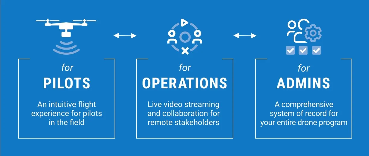
for Pilots
Provide pilots with a standardized flight control interface for all types of drones in your fleet while simultaneously enabling automatic flight logging and remote live
streaming.
- View elevations in AGL, MSL & Height Above Terrain (HAT)
- Consume, view, and record multiple types of video, including thermal
- Adjust radio settings to improve performance in challenging RF environments
for Operations
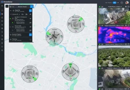
Give incident command complete situational awareness with secure access to live video and telemetry data from pilots on-scene as well as advanced GIS tools from your connected desktop or mobile device.
- Visualize all drone locations and secure live video feeds in real time to maximize scene intelligence
- Utilize advanced map features like Esri base layers, overlays, and measuring tools
- Build custom feature layers to create a common operating picture and more effectively communicate key locations with your operating team
- Coordinate missions with other agencies from within Operations Hub by issuing external collaborators a simple six-digit code.
for Admins
DroneSense is a full system of record for your entire drone program that provides accountability and transparency across your organization. Organize your people, hardware, flight activity, and more in a powerful and intuitive interface.
- View detailed, automatically recorded flight logs
- Monitor pilot flight activity and total flight hours
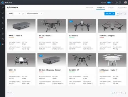
- Ensure asset readiness with comprehensive hardware management, including aircraft, batteries, and tablets


